A guide to hiking up Ben Ledi in Scotland
Our top picks for the most spectacular views
Where is Ben Ledi?
Situated within Loch Lomond & The Trossachs National Park, Ben Ledi is a familiar landmark from the small town of Callander and one of the most popular hillwalks in the area boasting spectacular views. It is the highest hill in the Trossachs at 2,884 feet, just missing out on Munro status by 116 feet. It is situated on the southern edge of the Highlands and is also part of the Queen Elizabeth Forest Park making it an ideal spot to travel to from our cabins at Strathyre. The hill offers fantastic views and on a clear day can be seen from Stirling, Calendar, and many other places in central Scotland.

Ben Ledi is the highest hill in the Trossachs at 2,884 feet.
How long does it take to climb Ben Ledi?
Well, this all depends on you. This 10.5km round trip will take between 4 and 6 hours. However, more advanced hikers may complete this in less time. The hill presents a steep climb, but it’s well worth the effort for the beautiful views you’ll be greeted to at the top. The main Ben Ledi walking route starts at the Forestry Commission car park where you will find a Ben Ledi map with information about the routes available.
The climb is well worth the effort for the beautiful views you’ll be greeted to at the top.
Is the Ben Ledi walk easy?
The path to the summit of Ben Ledi is well managed, maintained by the Forestry Commission and is easy to follow, winding through the vast woodland area. The decent is a little more challenging with some boggy sections therefore hillwalking gear must be carried.
The decent is a little more challenging so take care.
Where does the Ben Ledi walking route start?
The trail starts at the Ben Ledi car park, where the well-marked path meanders through a dense forest of pine and deciduous trees crossing a bridge over the Keltie Water. As the forest thins, the landscape opens to reveal the rugged hillside. The ascent becomes steeper and the terrain rougher, be sure to navigate the rocky sections with care!
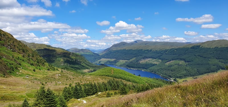
We suggest taking the route next to the bridge, turning left onto a waymarked footpath through the forest before ascending on a steep climb to the top. This route takes you along the east side of the hill, offering the best views of Loch Lubnaig. As your climb continues the views to the left are magnificent, with Ben Lomond and the Arrochar Alps forming a grand skyline.
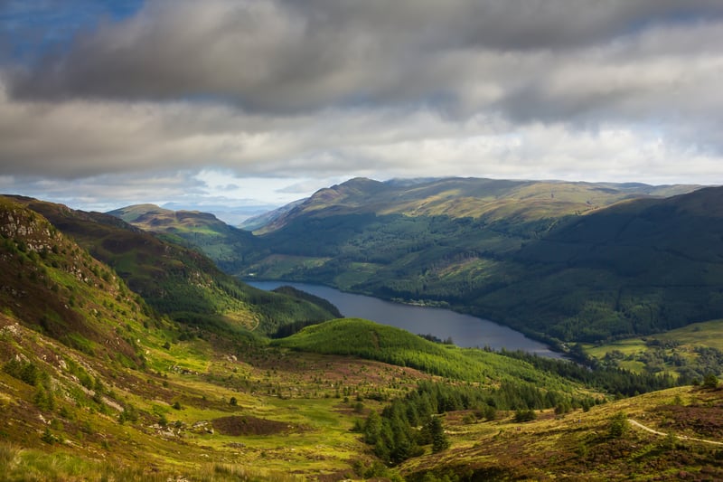
As your climb continues the views to the left are magnificent.
What views are there at Ben Ledi?
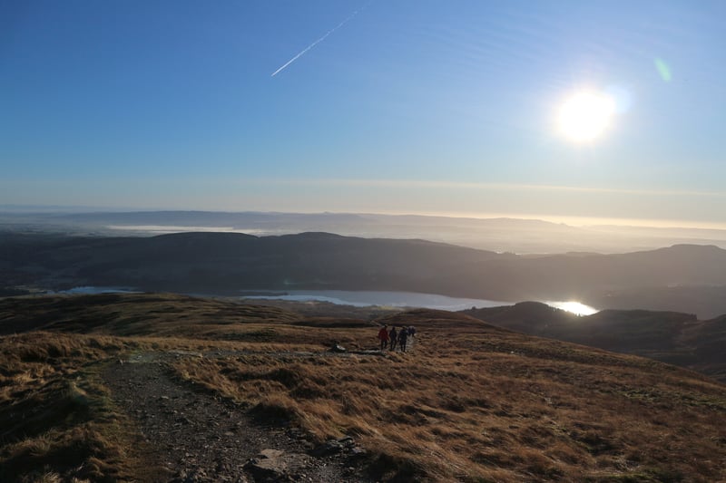
At the summit, a breathtaking panorama awaits. As mentioned, Loch Lubnaig glistens below, surrounded by majestic hills that stretch as far as the eye can see. The views over Callander really begin to take shape, featuring the Wallace Monument, and on a clear day even Stirling Castle.
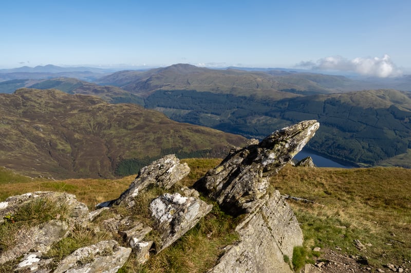
At the summit, a breathtaking panorama awaits.
With plenty of hiking trails to choose from, there is so much to be discovered on your UK staycation in Scotland. Looking for a place to call home on your next walking holiday? Our accommodation at Strathyre is a gateway to the Highlands, surrounded by forest, loch, and mountain. Spend the day exploring the Scottish landscape, before returning to your cosy hot tub cabin in the forest.
Useful information
Ben Ledi’s height: at 2,884 feet
Summit grid reference: NN 562 098
Translation: Hill of the long shoulder
Start Point: Car Park near South of Loch Lubnaig at the A84 (NN 587 090)